The Ser.P.I.Co. project. (Permanent Municipal Information Services) manages 28 municipalities around Verona that are members of the BIM ADIGE Consortium of Verona. Its main purpose is to provide management tools for the spatial data of homogeneous Urban Plans complying with the Veneto Region sector standards, thus optimising the interaction between the various bodies in charge of land management and favouring the exchange of information, providing support on topographic, cartographic and thematic data based on shared standards.
Another aim is to provide citizens with tools for the instruction of building practices and the issuing of CDUs (Town-Planning Use Certificates).
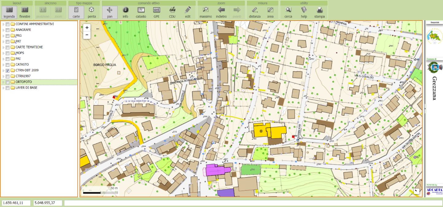
The project implements web-based GIS services for real-time data processing, visualisation, analysis and retrieval.
The initial phase of the project identified users, collected information and defined which priority applications were to be implemented according to current regulations and municipal competencies.
Therefore, a range of information was collected on:
The next step was to design the geodatabase, importing the information and organising it according to a relation model (ER) and defining:
With regard to the 'PentaView' images (5 synchronised aerial photos), a specific management system has been developed, integrated with the geoportal, which allows users to view the images and make planimetric and altimetric measurements of elements such as: buildings, roads, fences, structures, etc., the use of LIDAR data and the dynamic construction of elevated plans.
The last phase of the project involved the design and development of applications for the provision of vertical services, made available through their integration into the geoportal, for
Ser.P.I.Co. is managed by ARCADIA SIT in CLOUD (ARUBA) guaranteeing: controlled access, user profiling, security and incremental backup, as well as user training and support.
CLIENT: BIM ADIGE Consortium - VERONA