ARCADIA SIT is a partner in a European consortium for the provision of GIS and remote sensing services under the Desis framework contract. The project is developed by JRC - IPSC - Institute for the Protection and Security of Citizens / MARS - Monitoring of Agricultural Resources. Development and implementation, since 1992, of an agricultural crops forecasting system in Europe.
The system provides annual harvest estimates at the European level by monitoring crop growth and vegetation analysis of short-term weather effects. The geographical area covered is continental Europe and on a sub-regional level, West Africa.
The input data used are:
The AGRI4CAST project organises various types of information and geographical data in a huge database:
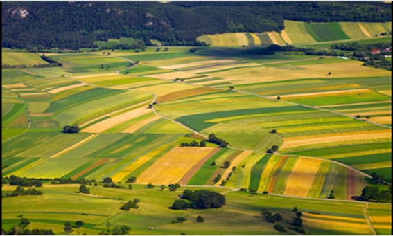
For EU countries, information is collected and organised to provide forecasting models for different types of agricultural production. From this information, variable dimension vector grids are generated to create an EU-wide coverage summarising input and output data.
The information underlying the AGRI4CAST project is managed and processed using ArcGIS Desktop for the analysis phases involving the intersection of the various vector themes: CorineLand Cover, soil map, agricultural production data, weather, etc. These elaborations aim to identify homogeneous areas for production potential, also by combining information on previous productions.
Information is transposed onto regular grids of different sizes to calculate indicators and thus provide input data to predictive models.
The development of information infrastructures and systems (INSPIRE, SEIS, GEOSS, G M ES, RSDI) aims at sharing environmental observations, information and analytical models and promoting interoperability and standard setting.
Also, for information analysis and scenario production:
The activities are based on expertise in crop modelling, agro-meteorology, sampling methods, environmental geo-spatial analysis, econometrics and the use of European and global data infrastructures. From this skill set, evidence-based information and predictions are generated for the management of agricultural practices and food safety alerts.
The project promotes the development of control systems, such as land parcel management and remote sensing controls, for the efficient implementation of the Common Agricultural Policy, including greening aspects. We carry out assessments of the effectiveness, efficiency, relevance and sustainability of policy measures based on their impact on the rural environment and food security, which includes the issue of climate change adaptation and possible mitigation, cross-referencing input data with GIS, data mining and ad-hoc routines to analyse the data and produce output:
AGRI4CAST investigates impacts on agricultural yield levels with model simulations based on BioMA and constrained by chosen climate change scenarios, focusing on short- and medium-term time horizons (e.g. 2020, 2050). The AGRI4CAST climate change activities also explore regional vulnerabilities in agricultural production and the effects of selected adaptation strategies to mitigate the effects of climate change.
The project promotes culture-related policies and specific attention to new measures that promote biodiversity, environmental quality and resource efficiency. Studies are underway within the AGRI4CAST project, assessing the impact of a changing climate on agricultural yields in Europe, identifying the vulnerabilities and resilience of agricultural production systems under a range of climate change scenarios and evaluating different mitigation measures for the identified impacts.
CLIENT: JRC (ISPRA) EU