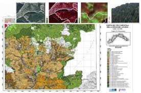
Production of forest maps at a scale of 1: 25,000 using remote sensing, photo interpretation and field survey techniques using GPS.
First, sample areas were identified on which to test the interpretative keys derived from the analysis of satellite images. Further verification was then carried out using ground survey instruments. The forest areas were then photo-interpreted and classified on the basis of the main species contained in each polygon.
Both automatic and manual quality tests were carried out during the project and at its conclusion.
List of main activities carried out:
CLIENT: Liguria Region